
Need segment-level traffic data?
Identify traffic patterns street by street and analyze the exact corridors that matter to your project.
Traffic | vehicles per day10,243 |
|---|---|
Trucks | 7.2% |
Average travel time | 35.7 min |
Congestion ratio | 26.9% |
Drivers’ average age | 43.5 yrs |
Drivers’ average income | $90,058 |
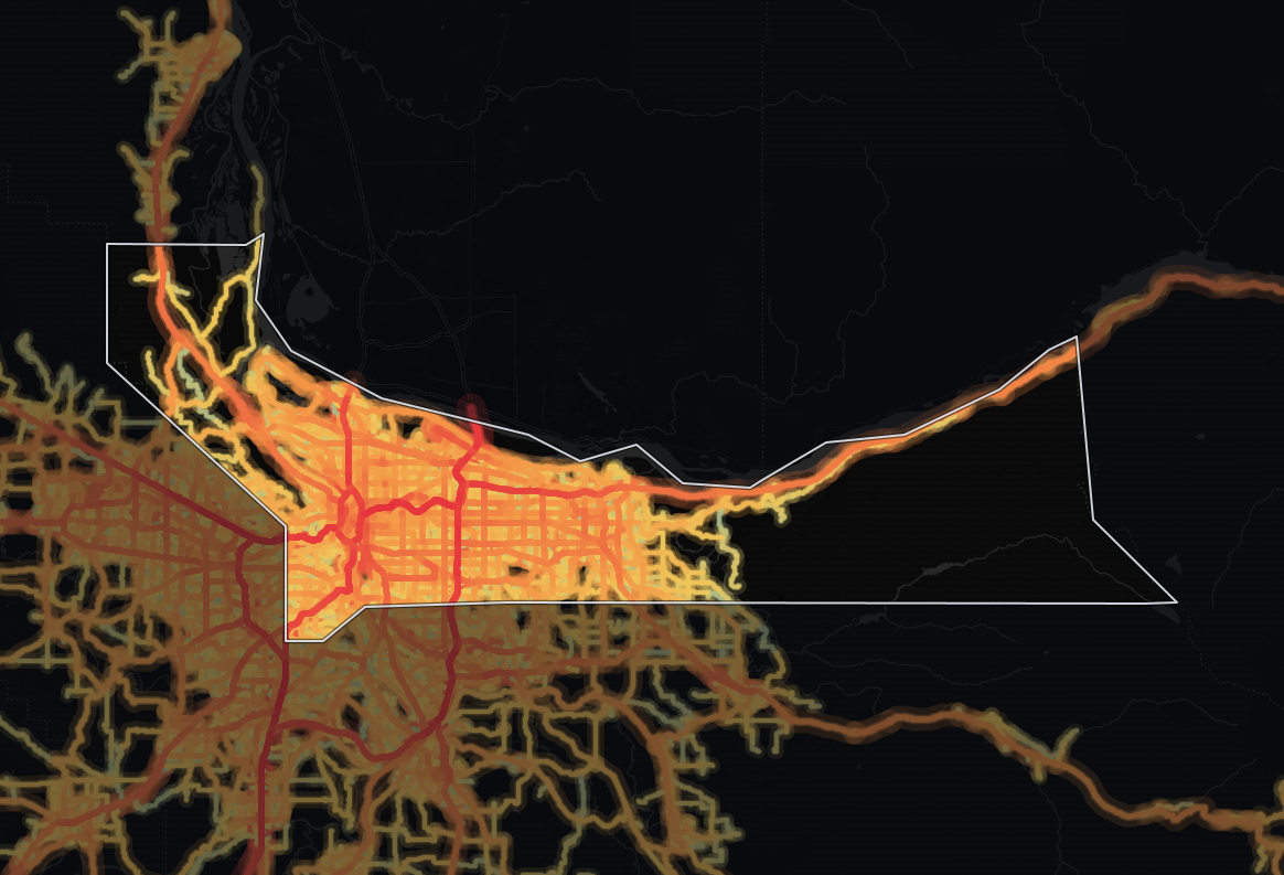
The average monitored road in Multnomah County, Oregon carries 10,243 vehicles per day. Across its 1,062 miles of monitored roads, that adds up to 13,759,969 vehicle-miles traveled per day (≈5.0 billion per year). Trucks are a smaller part of the mix than across Oregon: 7.2% against 9.2%.
At 10,243 vehicles per day, the average monitored road in Multnomah carries 73% more traffic than the state average of 5,908, suggesting more demand on each road - heavy exposure for roadside retail, and tight road space for deliveries. Network-wide, Multnomah accounts for about 16% of Oregon's statewide total of vehicle-miles. At 10,243 vehicles per day, Multnomah posts the highest average traffic volume in Oregon.
The average trip takes 35.7 minutes, on par with the state level. Its average travel time of 35.7 minutes is longer than 63% of counties in Oregon.
The congestion ratio of 26.9% is 62% higher, pointing to more pronounced congestion than the state level - peak-hour routing and delivery windows need real slack here.
| Traffic | vehicles per day32,490 |
|---|---|
| Trucks | 9.0% |
| Average travel time | 39.9 min |
| Congestion ratio | 50.7% |
| Drivers’ average age | 43.8 yrs |
| Drivers’ average income | $91,188 |
Highways carry about half of all travel in Multnomah County, Oregon, 49% of vehicle-miles. The average highway carries 32,490 vehicles per day, 243% more than the average non-highway road in the same area, which carries 9,480 vehicles per day.
Highways make up 18% of the monitored road miles (188 miles, 1,456 segments), so they carry more than their share: 6,799,403 vehicle-miles traveled per day (≈2.5 billion per year).
That is the most highway travel volume of any county in Oregon.
Highway truck concentration here runs 25% lower than the state average, at 9.0%. Trucks are a small share of a very large highway flow, so Multnomah still moves heavy freight volumes alongside its passenger traffic.
Multnomah's highway truck share (9.0%) is lower than 62% of counties in Oregon. By raw volume, Multnomah carries the highest number of highway trucks in Oregon - roughly 3,248 trucks per day.
| Traffic | vehicles per day9,480 |
|---|---|
| Trucks | 5.5% |
| Average travel time | 35.6 min |
| Congestion ratio | 26.1% |
| Drivers’ average age | 43.2 yrs |
| Drivers’ average income | $89,279 |
Local roads carry about half of all travel in Multnomah County, Oregon, 51% of vehicle-miles. A typical local road sees 9,480 vehicles per day.
Local roads make up 82% of the monitored road miles (874 miles in 42,465 segments) but carry less than their share of travel: 6,960,566 vehicle-miles traveled per day (≈2.5 billion per year). About 1 in 18 vehicles on non-highway roads is a truck (5.5%).
Compared to highways, non-highway routes see 39% fewer trucks by share.
Non-highway congestion (26.1%) runs 62% higher than the state average, pointing to slower local traffic flow.
Trip origins here have higher average income than 89% of counties in Oregon. The driver population here skews younger than 91% of counties in Oregon.


Mobile device location data (anonymized and aggregated)
Road sensor networks and traffic counters
Historical traffic pattern databases

Identify traffic patterns street by street and analyze the exact corridors that matter to your project.



