
Need segment-level traffic data?
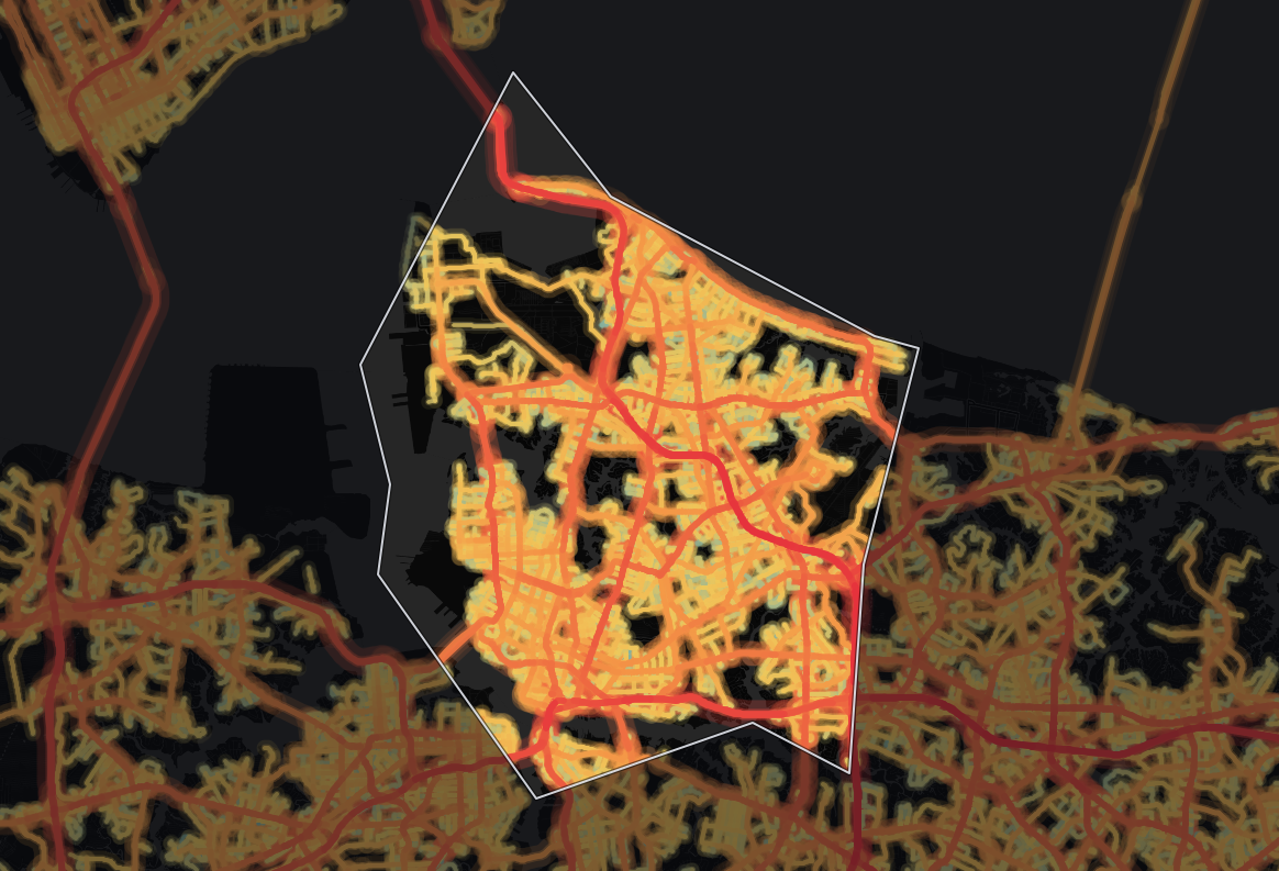
Identify traffic patterns street by street and analyze the exact corridors that matter to your project.
Traffic | vehicles per day10,118 |
|---|---|
Trucks | 6.5% |
Average travel time | 31.4 min |
Congestion ratio | 22.4% |
Drivers’ average age | 40.2 yrs |
Drivers’ average income | $77,105 |
Our data shows 10,118 vehicles per day on the average road in Norfolk City, Virginia, and 4,474,423 vehicle-miles traveled per day (≈1.6 billion per year) across its 327 miles of monitored roads. Trucks are a smaller part of the mix than across Virginia: 6.5% against 9.6%.
At 10,118 vehicles per day, the average monitored road in Norfolk carries 89% more traffic than the state average of 5,349, suggesting more demand on each road - heavy exposure for roadside retail, and tight road space for deliveries. Network-wide, Norfolk accounts for about 2.0% of Virginia's statewide total of vehicle-miles. By volume, Norfolk's 10,118 vehicles per day outpaces 92% of counties in Virginia.
The average trip takes 31.4 minutes, on par with the state level. Its average travel time of 31.4 minutes is shorter than 60% of counties in Virginia.
Congestion runs 33% higher than the state level, at a ratio of 22.4%, which means more pronounced congestion - a factor for delivery windows and signal timing.
| Traffic | vehicles per day33,558 |
|---|---|
| Trucks | 8.7% |
| Average travel time | 33.3 min |
| Congestion ratio | 57.8% |
| Drivers’ average age | 41.9 yrs |
| Drivers’ average income | $83,232 |
Highways carry about half of all travel in Norfolk City, Virginia, 52% of vehicle-miles. The average highway carries 33,558 vehicles per day, 296% more than the average non-highway road in the same area, which carries 8,466 vehicles per day.
Highways make up 22% of the monitored road miles (73 miles, 630 segments), so they carry more than their share: 2,319,666 vehicle-miles traveled per day (≈847 million per year).
By highway travel volume, Norfolk outranks 89% of counties in Virginia.
The concentration of trucks on highways (8.7%) is 34% lower than the state average for similar road classifications. Highways here mostly serve passenger trips, so local access matters more than long-haul routing for logistics operators.
Norfolk's highway truck share (8.7%) is lower than 82% of counties in Virginia. By raw truck volume, Norfolk carries more highway trucks than 72% of counties in Virginia.
| Traffic | vehicles per day8,466 |
|---|---|
| Trucks | 4.1% |
| Average travel time | 31.2 min |
| Congestion ratio | 19.9% |
| Drivers’ average age | 37.8 yrs |
| Drivers’ average income | $70,580 |
Local roads carry about half of all travel in Norfolk City, Virginia, 48% of vehicle-miles. The average non-highway road carries 8,466 vehicles per day.
Spread over 254 miles and 8,938 segments, 78% of the road network, local roads carry a lighter load per mile: 2,154,757 vehicle-miles traveled per day (≈786 million per year). Trucks make up 4.1% of non-highway traffic, about 1 in 25 vehicles.
Compared to highways, non-highway routes see 53% fewer trucks by share.
Non-highway congestion (19.9%) runs 27% higher than the state average, pointing to slower local traffic flow.
Trip origins here have higher average income than 55% of counties in Virginia. Norfolk's median driver age is lower than 99% of counties in Virginia.


Mobile device location data (anonymized and aggregated)
Road sensor networks and traffic counters
Historical traffic pattern databases

Identify traffic patterns street by street and analyze the exact corridors that matter to your project.



