
Need segment-level traffic data?
Identify traffic patterns street by street and analyze the exact corridors that matter to your project.
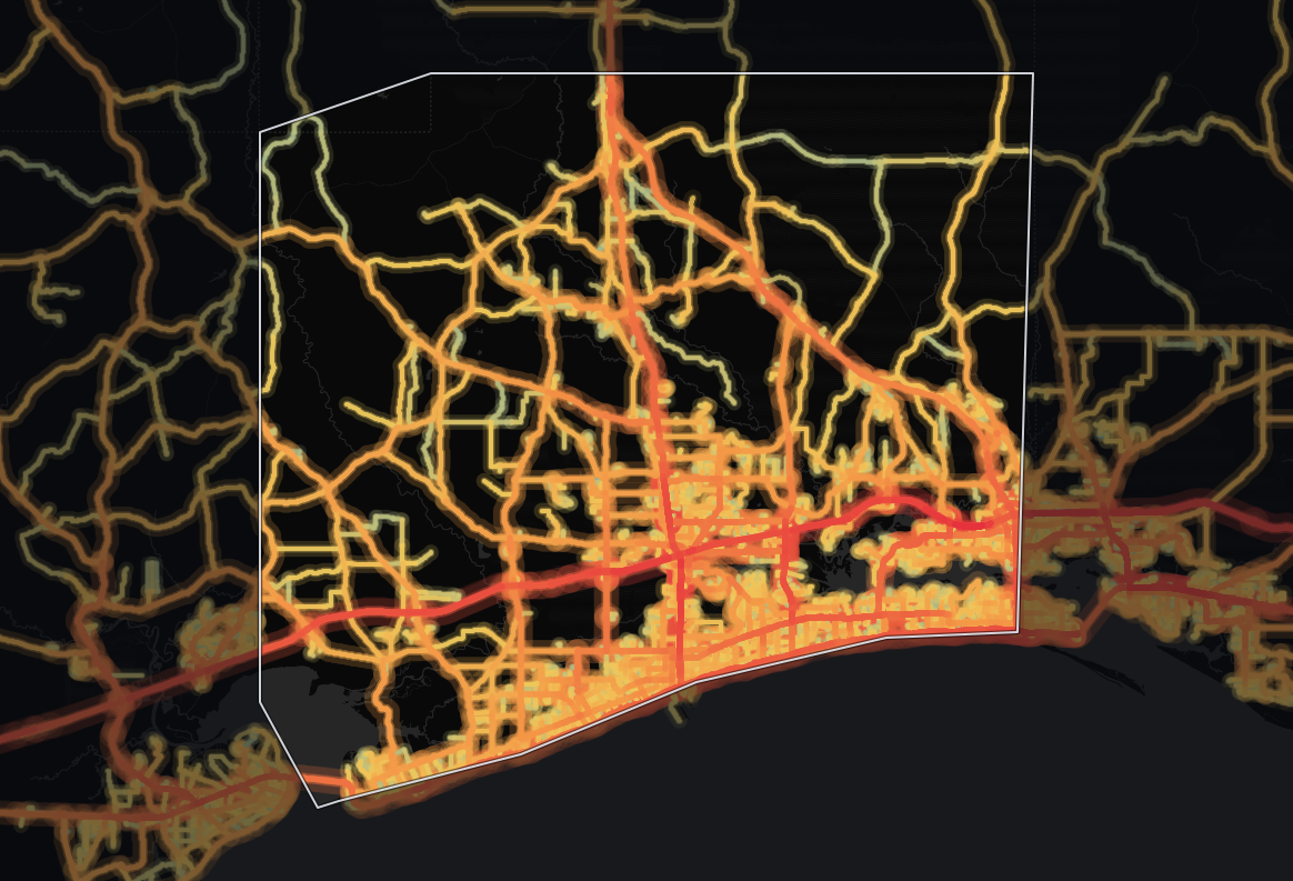
Traffic | vehicles per day13,207 |
|---|---|
Trucks | 7.5% |
Average travel time | 31.5 min |
Congestion ratio | 31.6% |
Drivers’ average age | 46.1 yrs |
Drivers’ average income | $68,584 |
The average monitored road in Harrison County, Mississippi carries 13,207 vehicles per day. Across its 717 miles of monitored roads, that adds up to 9,299,337 vehicle-miles traveled per day (≈3.4 billion per year). Trucks are a smaller part of the mix than across Mississippi: 7.5% against 11.1%.
Harrison's average daily traffic volume is 148% higher than the state average - 13,207 vehicles per day against 5,319 - suggesting more traffic load per road - heavy exposure for roadside retail, and tight road space for deliveries. Across the whole network, that travel is about 9.4% of Mississippi's statewide total. Harrison stands out as having the highest traffic volume in Mississippi - 13,207 vehicles per day.
Journey times here (31.5 minutes on average) closely track the state level. 52% of counties in Mississippi have a longer average travel time than Harrison's 31.5 minutes.
Congestion runs 108% higher than the state level, at a ratio of 31.6%, which means more pronounced congestion - expect markedly slower peak-hour deliveries and unreliable arrival times.
| Traffic | vehicles per day26,143 |
|---|---|
| Trucks | 11.6% |
| Average travel time | 35.5 min |
| Congestion ratio | 49.3% |
| Drivers’ average age | 46.6 yrs |
| Drivers’ average income | $70,334 |
Highways carry a significant share of travel in Harrison County, Mississippi: 39% of all vehicle-miles. The average highway carries 26,143 vehicles per day, 109% more than the average non-highway road in the same area, which carries 12,527 vehicles per day.
Highways make up 20% of the monitored road miles (141 miles, 629 segments), so they carry more than their share: 3,655,476 vehicle-miles traveled per day (≈1.3 billion per year).
By highway travel volume, that ranks Harrison in the top 3 counties in Mississippi.
Highway truck concentration here runs 27% lower than the state average, at 11.6%. Trucks are a small share of a very large highway flow, so Harrison still moves heavy freight volumes alongside its passenger traffic.
90% of counties in Mississippi see a higher highway truck share than Harrison's 11.6%. By raw truck volume, Harrison carries more highway trucks than 95% of counties in Mississippi.
| Traffic | vehicles per day12,527 |
|---|---|
| Trucks | 4.8% |
| Average travel time | 31.3 min |
| Congestion ratio | 30.6% |
| Drivers’ average age | 46.0 yrs |
| Drivers’ average income | $67,636 |
A little more than half of the driving in Harrison County, Mississippi happens on local roads: 61% of all vehicle-miles. On the average non-highway road, that comes to 12,527 vehicles per day.
Local roads make up 80% of the monitored road miles (576 miles in 11,962 segments) but carry less than their share of travel: 5,643,861 vehicle-miles traveled per day (≈2.1 billion per year). Trucks make up 4.8% of non-highway traffic, about 1 in 21 vehicles.
Compared to highways, non-highway routes see 58% fewer trucks by share.
Non-highway congestion (30.6%) runs 104% higher than the state average, pointing to slower local traffic flow.
Harrison's average driver income is higher than 88% of counties in Mississippi. 53% of counties in Mississippi have an older driver population than Harrison.


Mobile device location data (anonymized and aggregated)
Road sensor networks and traffic counters
Historical traffic pattern databases

Identify traffic patterns street by street and analyze the exact corridors that matter to your project.



