
Need segment-level traffic data?
Identify traffic patterns street by street and analyze the exact corridors that matter to your project.
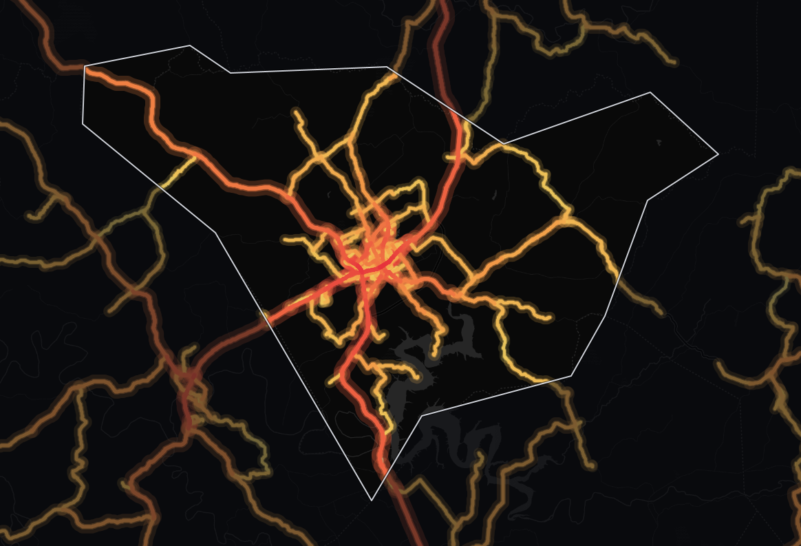
TrafficThe average number of vehicles that travel each day over any road in the road network. | vehicles per day3,976 |
|---|---|
TrucksThe percentage of the total traffic volume composed of heavy vehicles. | 8.7% |
Average travel timeThe average time of travel averaged among all vehicles traveling on the road network. | 25.7 min |
Congestion ratioThe rate at which the actual travel time exceeds free-flow travel time, averaged among all roads in the network. | 10.5% |
Drivers’ average ageAverage age of residents in the geographic areas where the vehicle trips originated. | 47.6 yrs |
Drivers’ average incomeAverage income of residents in the geographic areas where the vehicle trips originated. | $64,468 |
The average monitored road in Taylor County, Kentucky carries 3,976 vehicles per day. Across its 190 miles of monitored roads, that adds up to 490,146 vehicle-miles traveled per day (≈179 million per year). About 1 in 12 vehicles is a truck, fewer than the 1 in 8 across Kentucky.
At 3,976 vehicles per day, the average monitored road in Taylor carries 15% less traffic than the state average of 4,696, suggesting less demand on each road - a factor worth weighing in site selection and logistics planning. Across the whole network, that travel is about 0.4% of Kentucky's statewide total. By volume, Taylor's 3,976 vehicles per day outpaces 81% of counties in Kentucky.
At 25.7 minutes, the average travel time is 19% lower than the state level. 97% of counties in Kentucky have a longer average travel time than Taylor's 25.7 minutes.
At 28% lower than the state level, the 10.5% congestion ratio signals smoother traffic flow - travel times are easy to plan around for scheduled deliveries.
| Traffic | vehicles per day9,156 |
|---|---|
| Trucks | 9.9% |
| Average travel time | 29.4 min |
| Congestion ratio | 16.8% |
| Drivers’ average age | 47.8 yrs |
| Drivers’ average income | $63,440 |
Highways carry more than half of all travel in Taylor County, Kentucky (64% of vehicle-miles). The average highway carries 9,156 vehicles per day, 308% more than the average non-highway road in the same area, which carries 2,243 vehicles per day.
Highways make up 22% of the monitored road miles (42 miles, 439 segments), so they carry more than their share: 312,408 vehicle-miles traveled per day (≈114 million per year).
Highway truck concentration here runs 38% lower than the state average, at 9.9%. Highways here mostly serve passenger trips, so local access matters more than long-haul routing for logistics operators.
Taylor's highway truck share (9.9%) is lower than 86% of counties in Kentucky. 56% of counties in Kentucky see more highway trucks per day than Taylor's roughly 906.
| Traffic | vehicles per day2,243 |
|---|---|
| Trucks | 6.5% |
| Average travel time | 24.5 min |
| Congestion ratio | 8.4% |
| Drivers’ average age | 47.1 yrs |
| Drivers’ average income | $66,422 |
Local roads carry a significant share of travel in Taylor County, Kentucky: 36% of all vehicle-miles. A typical local road sees 2,243 vehicles per day.
Spread over 148 miles and 1,312 segments, 78% of the road network, local roads carry a lighter load per mile: 177,738 vehicle-miles traveled per day (≈64.9 million per year). Trucks make up 6.5% of non-highway traffic, about 1 in 15 vehicles.
Compared to highways, non-highway routes see 35% fewer trucks by share.
Non-highway congestion (8.4%) runs 39% lower than the state average, pointing to smoother local traffic flow.
Trip origins here have higher average income than 63% of counties in Kentucky. 63% of counties in Kentucky have an older driver population than Taylor.
The highway truck share sets Taylor County apart: 38% below the Kentucky average. Its truck share is also 28% below.
| Metric | Taylor County | Kentucky average | Difference |
|---|---|---|---|
| Traffic | 3,976 | 4,696 | -15.3% |
| Truck % (Total Traffic) | 8.7% | 12.1% | -28.2% |
| Truck % (Highway) | 9.9% | 15.9% | -37.6% |
| Avg. Travel Time | 25.7 min | 31.7 min | -18.8% |
Against the 4 nearest areas, Taylor County carries 85.9% more traffic on a typical road; it has the busiest roads of the five.
| Area | Average daily traffic | Truck share | Daily vehicle-miles | Average travel time | Congestion ratio |
|---|---|---|---|---|---|
| Taylor County | 3,976 | 8.7% | 490,146 | 25.7 min | 10.5% |
| Adair County, Kentucky | 2,341 | 12.8% | 804,780 | 29.7 min | 10.1% |
| Green County, Kentucky | 1,745 | 9.3% | 230,047 | 33.0 min | 7.8% |
| Marion County, Kentucky | 2,868 | 9.0% | 452,831 | 29.1 min | 9.1% |
| Casey County, Kentucky | 1,599 | 9.4% | 258,838 | 31.3 min | 5.9% |
| Kentucky average | 4,696 | 12.1% | N/A | 31.7 min | 14.7% |
Taylor County sits in the bottom quarter of the Kentucky field on average travel time, at #116 of 120.
| Measure | Taylor County | Kentucky rank |
|---|---|---|
| Traffic volume (AADT) | 3,976 | #24 of 120 |
| Highway vehicle-miles per day | 312,408 | #66 of 115 |
| Truck share on highways | 9.9% | #99 of 115 |
| Highway trucks per day | 906 | #65 of 115 |
| Average travel time | 25.7 min | #116 of 120 |
| Average driver income | $64,468 | #45 of 120 |
| Average driver age | 47.6 yrs | #76 of 120 |
The two ends of this table sit far apart: #24 of 120 on average daily traffic volume, against #116 of 120 on average travel time.
On their busiest stretches, the three busiest roads in Taylor County carry 12,068 vehicles a day on average, 3.0 times the typical road in the county (3,976).
Broadway Street is the busiest road, at 13,565 vehicles a day, 1,327 of them trucks (9.8%). It tops the truck ranking too, with the most trucks.
New Campbellsville Road carries longer journeys than most roads here, with a median trip of 40.4 minutes against 25.7 county-wide.
Broadway Street peaks at 13,565 vehicles a day, 3.4 times the county average; trucks are 9.8% of it, above the county-wide 8.7%.
Travel on Campbellsville Bypass's busiest stretch runs 37% over free-flow time, against 11% across the county, so expect slower peak hours.
West Broadway carries 2.5 times the county average at its busiest, 832 of them trucks (8.2%, below the county-wide 8.7%).
Greensburg Road is one of the more congested roads here: trips take 26% longer than at free-flow speed, against 11% county-wide.
New Columbia Road carries 2.2 times the county average on its busiest stretch, where the median trip lasts 32.1 minutes.
New Campbellsville Road is busy by local standards, at 70% more than the county average on its busiest stretch; trucks are 12.9% of it, above the county-wide 8.7%.
Drivers on New Lebanon Road are on long journeys, a median 35.1 minutes against 25.7 county-wide: a through route more than a local street.
The average monitored road in Taylor carries 3,976 vehicles per day, 15% less than the Kentucky average of 4,696.
Taylor carries more traffic than 81% of counties in Kentucky, averaging 3,976 vehicles per day.
Approximately 23% of highway traffic and 4% of non-highway traffic consists of vehicles whose trip originates outside Taylor County, Kentucky. Even highway traffic is mostly local, so these roads mainly serve residents and commuters.
Weekday traffic has two busy windows: AM peak 10:00 AM–12:00 PM and PM peak 4:00 PM–6:00 PM - about 76% above the daily average.
Trucks make up about 8.7% of all traffic in Taylor County, Kentucky, rising to 9.9% on highways, where long-haul freight concentrates.
The average trip in Taylor takes 25.7 minutes, 19% shorter than the Kentucky average of 31.7 minutes, delays at signals and congestion included.
Broadway Street carries the most, 13,565 vehicles per day on its busiest stretch, followed by Campbellsville Bypass (12,502), West Broadway (10,137), Greensburg Road (9,234), New Columbia Road (8,804). Figures are AADT, both directions combined.
Broadway Street, with about 1,327 trucks per day on its busiest stretch, 9.8% of its 13,565 vehicles.
About 13,565 vehicles per day in both directions on its busiest stretch, including 1,327 trucks (9.8%). Traffic is lower on its quieter stretches; TrafficZoom shows the count for every segment.

Mobile device location data (anonymized and aggregated)

Road sensor networks and traffic counters

Historical traffic pattern databases
The same traffic breakdown for the areas closest to Taylor County, Kentucky.
Identify traffic patterns street by street and analyze the exact corridors that matter to your project.
